Skip to content

Survey photos, at the point they document

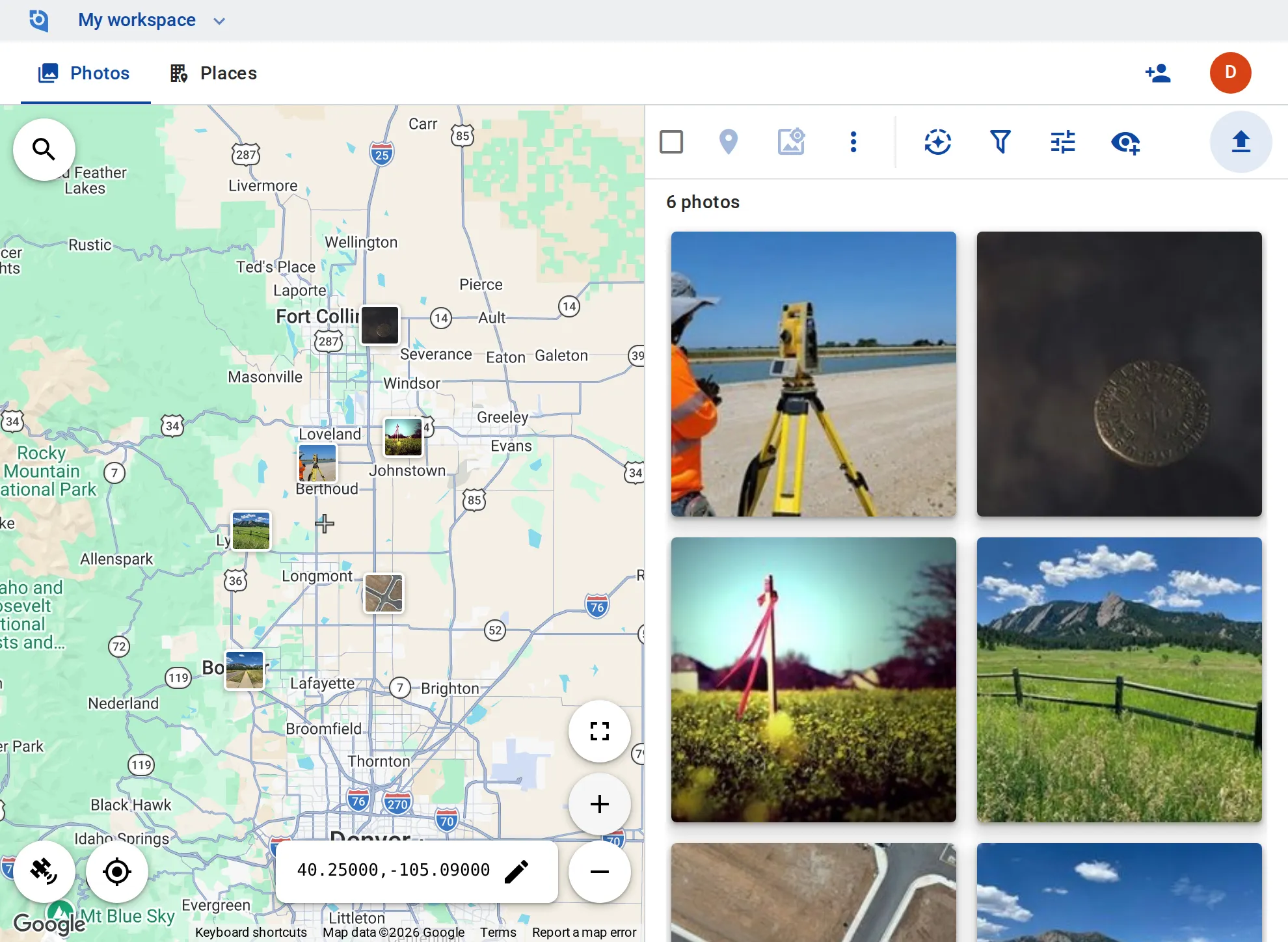
Found monuments, set pins, benchmarks and the ground around them: the field crew uploads, and the office sees each photo on the map at its point, filed under its job.
See pricing
GeoTag.com showing survey jobs along the Colorado Front Range on a map, with photos of monuments, corner markers and job sites

Why survey photos matter

Was the monument there?

Whether a monument was found, disturbed or set by your crew can matter years later, in a boundary question. A dated photo at that point backs up the field notes.

The next crew, the same corner

A crew going back to a job needs the pin the last crew photographed, not a folder of IMG files sorted by date.

Photos apart from the drawing

Field notes, the drawing and the photos live in different places, and matching a photo to its point by timestamp is slow work.

A place per job or point

Make each job a place, or each monument its own, with the point number in its description and tags such as “Found”, “Set” or “Disturbed”.

Position from the photo, or by hand

GPS comes from the photo. Where it is off, drag the marker to the spot, or move the map to typed coordinates and geotag the photo there.

Coordinates on the image

Stamp the coordinates, date and time, and the point number, onto the photo, so it reads the same in any report.

EXIF for your survey software

Write GPS, description, keywords and date into the copies you download, for software that reads EXIF — unlimited on Business.

Out to Google Earth and GIS

Export your places as a KMZ file and open the job in Google Earth or a GIS tool that reads KMZ.

Roles for crew and office

On Business, contributors add and edit their own photos and editors add and edit everything; viewers — free on every plan — view and download.

Put your survey jobs on the map

Contributor and editor roles and unlimited EXIF writing come with the Business plan: $100 per user a year, from 3 users, with a 14-day free trial.

See pricing

Request an invite

GeoTag is invitation only while we onboard a small group of people before launch. Write to us and we'll get back to you about an invite.

It helps to tell us:

  • what you'd use GeoTag for,
  • roughly how many photos or locations,
  • whether you'll use iPhone, Android or the browser.
hello@geotag.com

Email us